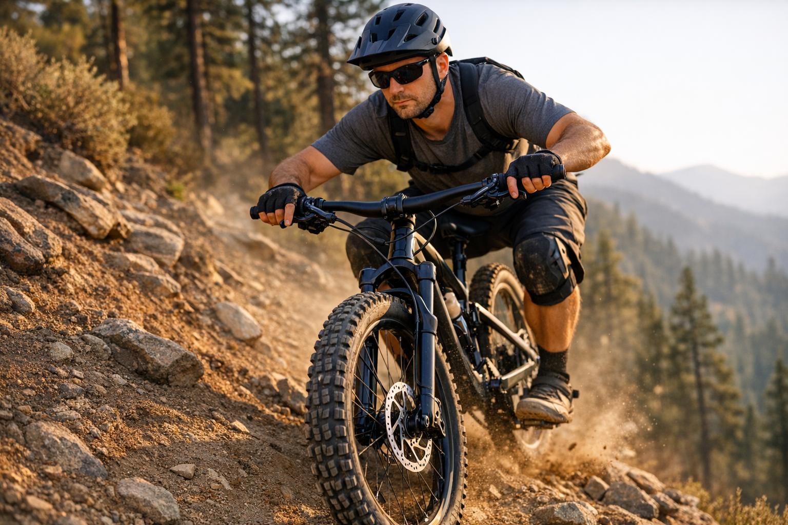
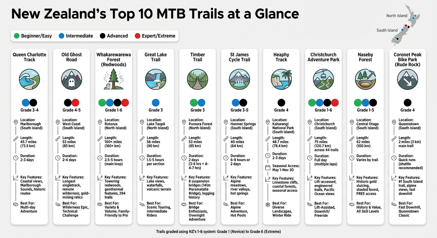
New Zealand is a dream destination for mountain bikers, offering diverse terrains and trails for all skill levels. From lush forests and volcanic landscapes on the North Island to rugged alpine tracks and coastal paths on the South Island, the options are endless. Here’s a quick look at the top 10 MTB trails:
- Queen Charlotte Track: Coastal trail with a mix of intermediate to advanced sections, offering stunning views of Marlborough Sounds.
- Old Ghost Road: New Zealand’s longest singletrack, ideal for advanced riders seeking remote wilderness and historical gold-mining routes.
- Whakarewarewa Forest (Redwoods): Rotorua’s extensive trail network with options for all skill levels, set in a geothermal wonderland.
- Great Lake Trail: Lakeside singletrack around Lake Taupō, featuring volcanic landscapes and waterfalls.
- Timber Trail: Scenic ride through Pureora Forest Park, known for suspension bridges and historic logging sites.
- St James Cycle Trail: High-country adventure through alpine meadows and river valleys, with challenging sections for experienced riders.
- Heaphy Track: Advanced trail through Kahurangi National Park, open to bikers seasonally, showcasing diverse landscapes.
- Christchurch Adventure Park: Lift-accessed trails for all levels, offering panoramic views and a modern bike park experience.
- Naseby Forest: Natural trails in Central Otago with historic gold-mining features and family-friendly options.
- Coronet Peak Bike Park (Rude Rock): Thrilling downhill trail near Queenstown with scenic alpine views.
Each trail has its own unique appeal, from historical connections to breathtaking scenery and technical challenges. Whether you’re a beginner or an expert, there’s a trail here for you.
Quick Comparison
| Trail Name | Location | Length | Difficulty | Key Features |
|---|---|---|---|---|
| Queen Charlotte Track | Marlborough | 45.7 miles | Intermediate/Advanced | Coastal views, historic routes |
| Old Ghost Road | West Coast | 53 miles | Advanced/Expert | Remote wilderness, gold-mining relics |
| Whakarewarewa Forest | Rotorua | 100+ miles | Beginner to Extreme | Towering redwoods, geothermal features |
| Great Lake Trail | Lake Taupō | 56 miles | Intermediate | Lake views, waterfalls, volcanic terrain |
| Timber Trail | Pureora Forest | 53 miles | Easy/Intermediate | Suspension bridges, logging history |
| St James Cycle Trail | Hanmer Springs | 40 miles | Intermediate/Advanced | Alpine meadows, river valleys |
| Heaphy Track | Kahurangi National Park | 48.7 miles | Advanced | Limestone cliffs, coastal forests |
| Christchurch Adventure Park | Christchurch | 44 trails | Beginner to Pro Line | Lift-accessed trails, Pacific Ocean views |
| Naseby Forest | Central Otago | 62 miles | Beginner to Advanced | Historic gold sluicing, shaded forest trails |
| Coronet Peak (Rude Rock) | Queenstown | 2 miles | Advanced | Fast downhill, alpine views |
This guide highlights the variety and beauty of New Zealand’s MTB trails, ensuring there’s something for every rider. Whether you prefer multi-day adventures or quick downhill runs, these trails promise unforgettable rides.
New Zealand’s Top 10 MTB Trails: Length, Difficulty & Key Features Comparison
🚴 What are the Best Places for Mountain Biking in New Zealand?
sbb-itb-9d75ae1
1. Queen Charlotte Track
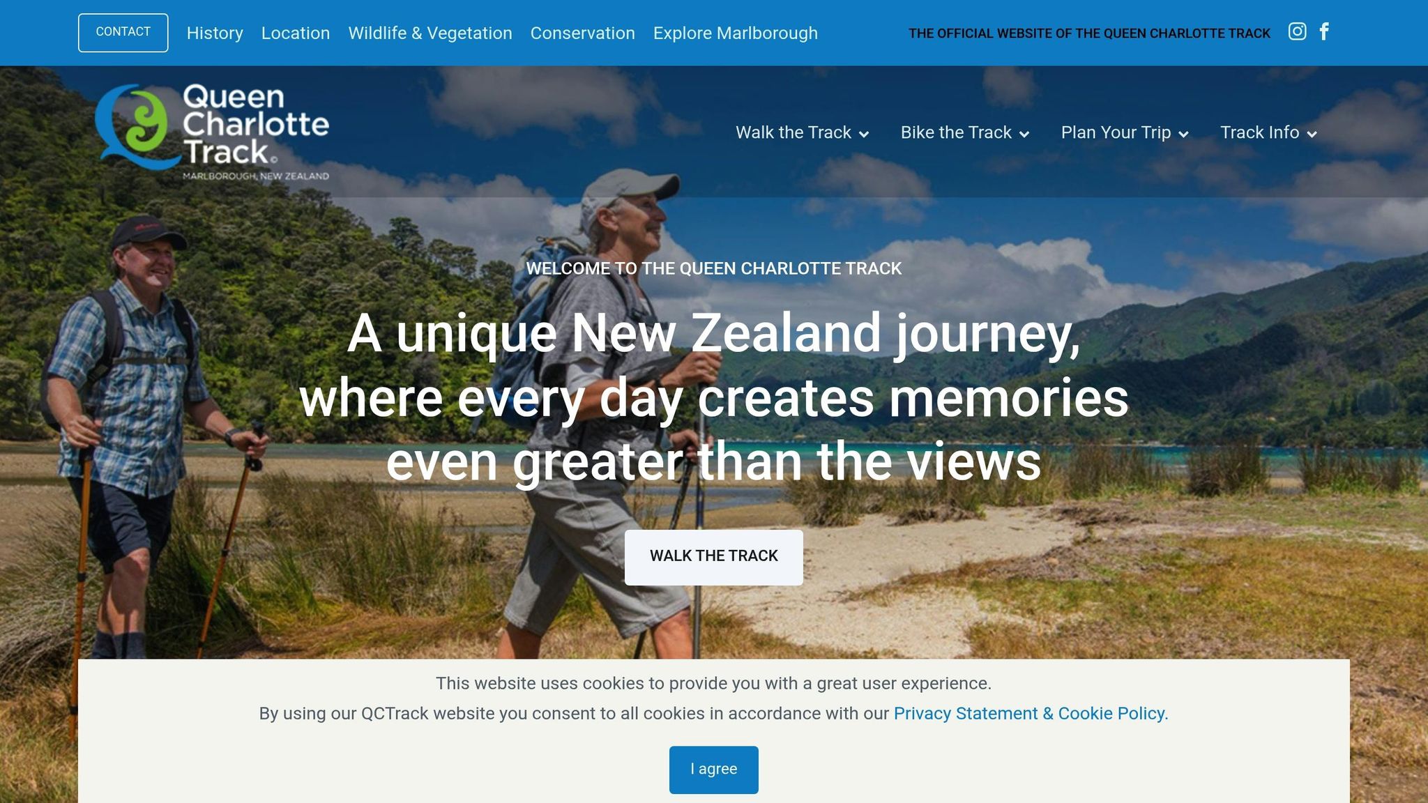
The Queen Charlotte Track is where technical riding meets stunning coastal landscapes. Stretching 73.5 km (45.7 miles), this trail takes you through the captivating terrain between Queen Charlotte Sound and Kenepuru Sound. Starting at Ship Cove – once a favored spot of Captain Cook – and ending at Anakiwa, this multi-day journey blends challenging singletrack with unforgettable views of the sounds.
Difficulty
This track is no walk in the park. It’s rated Grade 3 (Intermediate) to Grade 4 (Advanced), with some sections edging into Grade 5 (Expert). The steep climbs, especially out of Camp Bay and Torea Saddle, can push even seasoned riders to dismount and walk their bikes.
"The Queen Charlotte Track is among the best multi-day mountain bike routes in the country. It has the added advantage of being able to amend your itinerary if you need to and do some of the route on sealed roads if the going is getting too tough", notes Jonathan Kennett.
If you’re not up for the toughest ridgeline sections, you can opt for sealed roads to bypass areas like Kenepuru Saddle and Portage.
Length
The track is divided into three main sections, each with its own character:
- Ship Cove to Punga Cove: 29 km (18 miles)
- Punga Cove to Torea Saddle: 23.5 km (14.6 miles)
- Torea Saddle to Anakiwa: 20.5 km (12.7 miles)
Keep in mind, mountain bikers are not allowed on the Ship Cove to Kenepuru Saddle section during peak season (December 1 to February 28), but it reopens on March 1 .
Typical Riding Time
Most riders tackle the track over 2 to 3 days, but seasoned cyclists can power through it in just one day . The first segment usually takes around 5 hours, while the middle and final sections each require about 4 hours. For added convenience, water taxis from Picton can carry your gear between accommodations.
Scenic Highlights
The scenery on this track is nothing short of spectacular. From ridgelines, you’ll enjoy sweeping views of both Queen Charlotte and Kenepuru Sounds before descending into tranquil bays like Davies Bay and Mistletoe Bay. The trail takes you through native beech forests and past historic spots such as Resolution Bay and Endeavour Inlet. Along the way, you’ll encounter a mix of coastal forests, clay tracks, and rocky descents, all with breathtaking 360° vistas .
To access private land sections between Kenepuru Saddle and Anakiwa, you’ll need a Queen Charlotte Track Land Cooperative (QCTLC) Pass .
2. Old Ghost Road
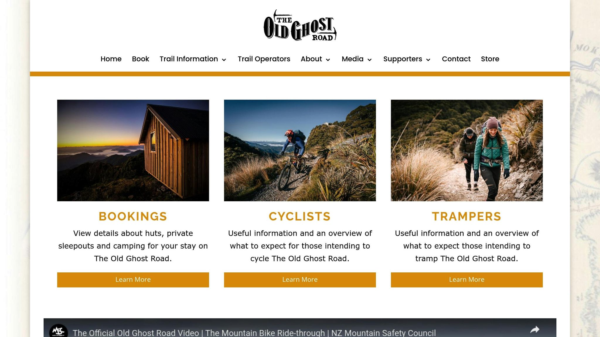
The Old Ghost Road is New Zealand’s longest continuous singletrack, stretching 85 km (52.8 miles) through some of the country’s most remote and rugged landscapes. This trail retraces a rediscovered 19th-century gold miners’ path, connecting the ghost town of Lyell to Seddonville. It’s rated as Grade 4 (Advanced), with certain sections hitting Grade 5 (Expert), making it a challenge tailored for fit and experienced riders.
Difficulty
Prepare for steep climbs, narrow tracks (15.7–23.6 inches wide), loose surfaces, and tight turns. The toughest stretch lies north of Ghost Lake along Skyline Ridge – a 2.5-mile section with steep, exposed edges and sudden drop-offs. As 100% Pure New Zealand cautions:
"The Old Ghost Road is a remote journey which takes you over rugged terrain, it is not suitable for unexperienced cyclist as it is a grade 4 (advanced) rating."
Riding from south to north is recommended since climbing technical sections is often easier to descend than ascend. To ensure the trail matches your skill level, watch the official planning and safety video.
This route demands both physical endurance and technical expertise, making it a journey that tests riders in every sense.
Length
The trail reaches a peak elevation of 1,280 m (4,200 ft) above sea level, with a total climb of approximately 2,226 m (7,304 ft) when riding south to north. Along the way, 21 bridges provide safe crossings over major waterways. In February 2024, Greg Heil of Singletracks documented a 76.23-mile out-and-back ride with an elevation gain of 11,655 ft. However, due to a landslide, the southern section remains closed until January 2025, requiring riders to start from Seddonville.
Beyond the stats, the route offers ever-changing scenery that keeps the ride engaging.
Typical Riding Time
Most skilled riders complete the trail in 2–4 days. Since there are no food or support services along the way, carrying all essential gear and supplies is crucial. Huts and campsites need to be booked well in advance, especially during the busy season from October to April. Staying in backcountry huts typically costs around $100 USD for the entire trip. Before leaving Ghost Lake Hut, double-check your brakes – an 800 m (2,625 ft) descent into Stern Valley awaits. Given the remote nature of the trail, carrying a Personal Locator Beacon (PLB) is a smart precaution.
Scenic Highlights
The Old Ghost Road combines history and natural beauty in a way few trails can. Riders traverse the alpine tops of the Lyell Range, enjoying sweeping views, including the dramatic Rocky Tor summit at 1,456 m (4,777 ft). Ghost Lake, a serene alpine tarn at 1,200 m (3,937 ft), sits below the Ghost Lake Hut, which itself perches on a 100-meter (328 ft) vertical cliff overlooking Skyline Ridge.
One of the trail’s most striking features is The Boneyard in Earnest Valley – a vast field of shattered rocks created by seismic activity. The New Zealand Cycle Trail describes it as "an unlikely and slightly unnerving place to ride a bike". Farther north, the trail follows the powerful white waters of the Mōkihinui River through a deep gorge lined with suspension bridges and ancient podocarp forests. Along the way, remnants of 19th-century gold mining settlements appear, and riders might encounter the Weka, a curious flightless bird notorious for stealing unattended items.
3. Whakarewarewa Forest (Redwoods)
Whakarewarewa Forest, often called "The Redwoods", boasts an impressive 160 km (99 miles) of trails spread across 5,600 hectares. This vast trail network has earned gold-level ride center recognition from the IMBA. As Red Bull TV aptly describes it:
"When we die and go to mountain bike heaven, there’s a good chance it will probably look like Rotorua."
Thanks to its volcanic, free-draining soil, these trails remain in great condition year-round, even after heavy rainfall. Below, you’ll find key details to help plan your ride, from trail difficulty to scenic must-sees.
Difficulty
With 294 trails graded from 1 (Beginner) to 6 (Extreme), Whakarewarewa Forest truly offers something for everyone. Beginners can stick to the flat, wide Grade 1 and 2 trails near the Waipa and Te Pūtake o Tawa carparks. Meanwhile, thrill-seekers can tackle the steeper, more technical descents and freestyle sections in the upper forest. A favorite for many is the Whakarewarewa Forest Loop, a 33 km (20.5-mile) "Great Ride." Mostly graded at Level 2 with some Level 3 sections, it’s an excellent introduction for riders of moderate skill.
Length
The forest’s trail network is as expansive as it is varied. Covering 160 km (99 miles), the standout Forest Loop spans 33 km (20.5 miles) and is divided into three sections:
- Waipa to Te Pūtake o Tawa: 10.5 km (6.5 miles)
- Te Pūtake o Tawa to Te Ara Ahi: 14 km (8.7 miles)
- Te Ara Ahi back to Waipa: 8.5 km (5.3 miles)
Access to the trails is free, and bike rentals range from $27 to $132 USD, depending on the type of bike and rental duration.
Typical Riding Time
Time on the trails varies depending on your pace and chosen routes. Most riders complete the 33 km Forest Loop in 2.5 to 5 hours. For example, the Waipa to Te Pūtake o Tawa section typically takes 1–2 hours. As professional downhill rider Brook Macdonald puts it:
"Whatever kind of riding you want, chances are Rotorua’s got it. The forest is so easily accessible from the city that even with limited time, you can get a good amount of riding in."
To help navigate the extensive trail system, riders can purchase a "Manky" (a map printed on a handkerchief) at the Visitor Center. Proceeds from these maps support trail maintenance.
Scenic Highlights
Beyond the thrill of the ride, the forest offers breathtaking scenery and fascinating geological features. Trails wind through groves of towering Californian Redwoods, Douglas Fir, and Eucalyptus, with native ferns carpeting the ground. Higher trails provide stunning views of Lake Tikitapu (Blue Lake) and Lake Rotokākahi (Green Lake), framed by the volcanic peaks of Mt. Tarawera. Adding to the magical atmosphere, you’ll encounter geothermal wonders like bubbling mud pools and steam vents at Te Pikitanga ki Whangapipiro. For a cultural touch, the Te Pūtake o Tawa area features five taonga – carvings by local Māori artists that share ancestral stories.
4. Great Lake Trail
The Great Lake Trail is a lakeside gem, offering 56 miles (90 km) of continuous singletrack around Lake Taupō, New Zealand’s largest lake. Recognized as one of just 11 International Mountain Biking Association (IMBA) Silver Level Ride Centers globally, this trail is a standout among New Zealand’s mountain biking destinations. The trail weaves through a landscape shaped by a massive supervolcanic eruption 27,000 years ago, which formed the caldera that now holds Lake Taupō [6,31].
Difficulty
Rated as Grade 3 (Intermediate), the trail caters to riders with some experience. However, there are sections that are beginner-friendly, such as the 20 km round trip from the Orakau car park to Kawakawa Bay, which features a gentle downhill slope. The trail’s pumice soil ensures it’s rideable in all seasons, making it a reliable choice year-round.
Length
The Great Lake Trail is divided into four main sections, each offering its own unique experience:
- Waihaha: 30 km (18.6 mi) of trail that follows the Waihaha River gorge to the secluded Waihora Bay. Many consider this the highlight of the trail.
- Kawakawa to Kinloch (K2K): 19.5 km (12.1 mi).
- Otaketake: 12 km (7.5 mi).
- Whakaipo to Kinloch (W2K): Ranges from 13 to 22.5 km (8.1–14 mi).
Some sections end in remote areas, so arranging a water taxi for access or return is highly recommended.
Typical Riding Time
Depending on the section, riding times vary between 1.5 and 5 hours:
- Waihaha: 4–5 hours
- K2K: 2.5–3.5 hours
- Otaketake: 1.5–2.5 hours
- W2K: 2.5–3.5 hours
For the Otaketake–K2K Loop, it’s best to ride counterclockwise for the most stunning views of Lake Taupō. Be sure to carry enough food and water, as services are only available in Kinloch.
Scenic Highlights
The trail offers breathtaking views of Lake Taupō, New Zealand’s largest lake. On the Waihaha section, riders can see Tieke Falls and Echo Rock before reaching the peaceful Waihora Bay. The K2K segment takes you through wetlands and regenerating forests, with incredible views of the western bays and the clear waters of Kawakawa Bay. The W2K section and the Headland Loop provide panoramic vistas of Lake Taupō, the Kaimanawa Ranges, and the volcanoes of Tongariro National Park. Keep in mind that the weather around the lake can change quickly, so pack clothing for all conditions – even during summer [31,33].
5. Timber Trail
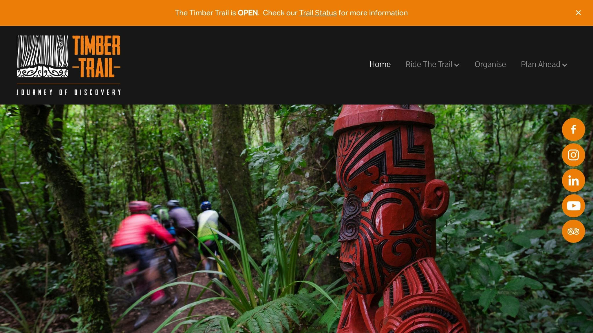
The Timber Trail stretches 85 km (52.8 mi) through the breathtaking Pureora Forest Park, offering a journey through lush podocarp forest, eight suspension bridges – including the impressive 141-meter-long Maramataha Bridge – and remnants of historic logging activity. Every year, around 20,000 cyclists and hikers take on this trail, which combines challenging terrain with stunning natural beauty and historic points of interest.
Difficulty
This trail is rated Grade 3 (Intermediate), featuring sustained climbs, uneven paths, and technical descents that demand solid bike-handling skills. Riders tackle 4,632 ft (1,412 m) of elevation gain and 5,790 ft (1,765 m) of descent. While the entire trail is best suited for those with a decent fitness level and some cycling experience, beginners can enjoy shorter Grade 2 (Easy) sections. E-bikes can make the uphill sections more manageable, but riders should exercise caution on the descents.
Length
Most riders complete the Timber Trail over two days. Day 1 covers approximately 23–24 miles and includes an 8.7-mile climb to the 940 m summit of Mt. Pureora. Day 2 spans about 26–27 miles, offering easier terrain with highlights like the Ongarue Spiral and long suspension bridges. Riding from north to south (starting in Pureora and finishing in Ongarue) is recommended, as it places the toughest climb at the beginning and features more downhill riding overall.
Typical Riding Time
Day 1 typically takes 3–6 hours, while Day 2 takes 4–7 hours. These timeframes help riders plan their two-day adventure effectively. Most cyclists park their vehicles in Ongarue and use a shuttle to reach Pureora. Since cell reception is limited along the trail, it’s wise to arrange transportation and accommodations ahead of time.
Scenic Highlights
The Timber Trail offers a feast for the senses: towering trees draped in moss, the melodies of native birds, and glimpses into the past with old tramlines and timber-milling relics. The eight suspension bridges provide breathtaking views of the forest canopy and valleys below. Engineering wonders like the Maramataha Bridge and the Ongarue Spiral add an extra layer of fascination to this journey through both nature and history.
6. St James Cycle Trail
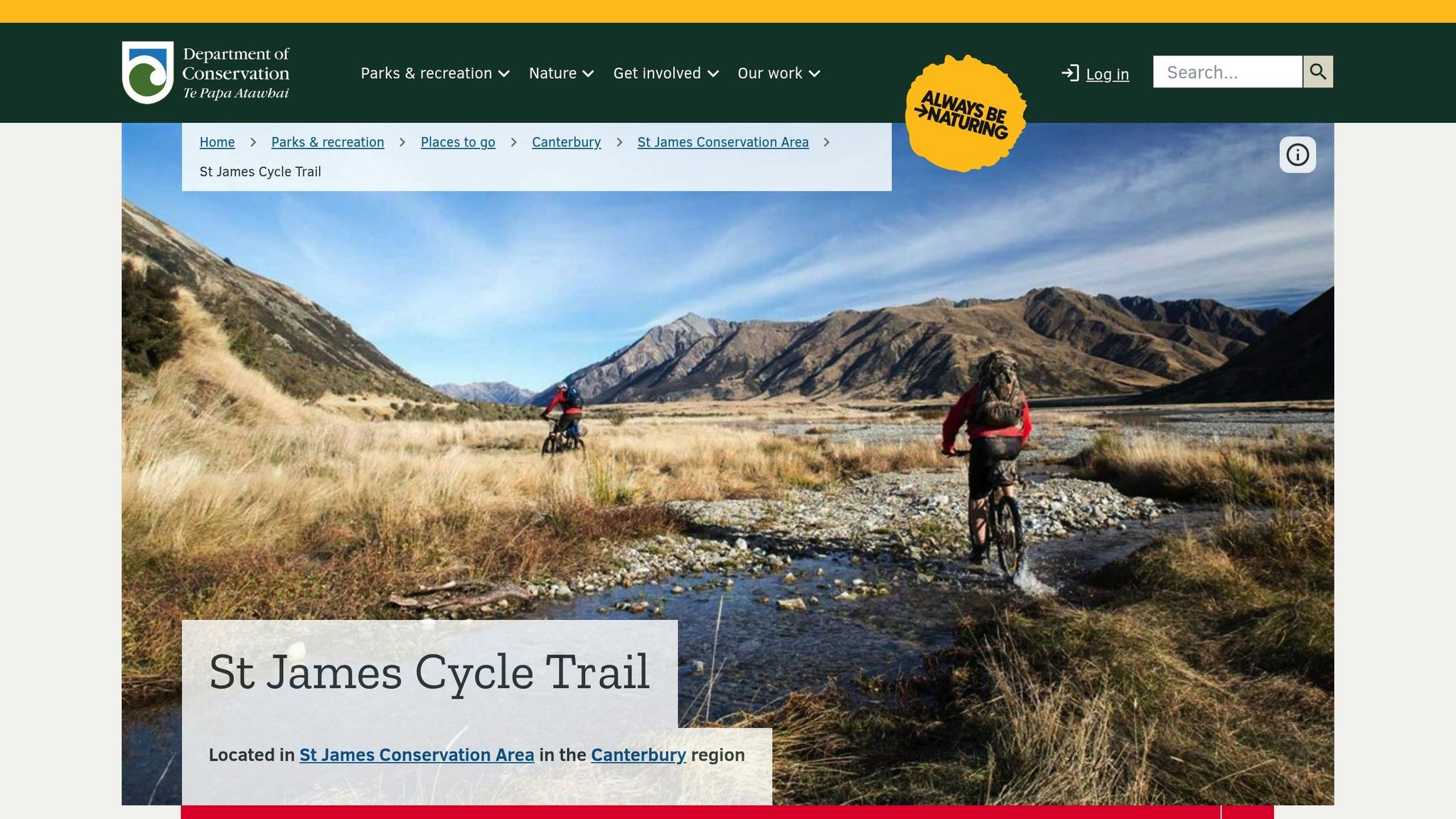
The St James Cycle Trail adds to New Zealand’s impressive range of coastal, forest, and alpine biking routes. Stretching roughly 40 miles (64 km), it winds through the vast 78,000-hectare (approximately 192,600 acres) St James Station, which was once one of the country’s largest high-country farms. This remote alpine trail takes riders from Maling Pass (4,291 ft/1,308 m) down through tussock grasslands, braided river valleys, and patches of mountain beech forest. The best time to ride is between November and April when conditions are most favorable.
Difficulty
The trail is mainly rated Grade 3–4 (Intermediate to Advanced), but certain challenging portions – especially between Saddle Spur Bridge and Scotties Hut – are marked as Grade 5, suitable only for expert riders. This section features a 240 m (787 ft) climb, rugged terrain, and steep drop-offs, requiring advanced bike handling skills. Riders should be well-prepared with tools, extra food, and a Personal Locator Beacon (PLB) since cellphone coverage is unreliable beyond Hanmer Springs.
Length
The entire trail spans about 40 miles (64 km) and is divided into four sections. For those looking for shorter rides, the 9.3-mile (15 km) Homestead Run Loop takes 2–3 hours, while a 20-mile (32 km) round trip to the Cow Stream hot pools is another option. The full route, starting at Maling Pass and ending at the Homestead, is mostly downhill.
Typical Riding Time
Experienced and fit riders can finish the trail in about 6–9 hours. However, many recommend splitting it into a two-day adventure to fully appreciate the stunning remote landscapes. Riders often stay overnight at Lake Guyon Hut, which costs $5 per adult per night, or take advantage of free options like Pool and Scotties Huts. Before heading out, check the trail’s condition with the Department of Conservation (DOC), especially since a mid-2021 flood caused damage to the McArthur swing bridge.
Scenic Highlights
The St James Cycle Trail is packed with breathtaking views. At Maling Pass, you’ll be greeted with sweeping vistas of the Waiau Valley and its surrounding peaks. A short, 20-minute detour leads to Lake Guyon, a crystal-clear alpine lake perfect for a picnic or a refreshing dip. Keep an eye out for wild horses grazing on the river flats near Saddle Spur Bridge, and don’t miss the 10-minute detour to the relaxing Cow Stream hot springs. The trail ends at the historic St James Homestead, where the well-preserved farm buildings from 1862 offer a glimpse into New Zealand’s high-country farming past. This mix of dramatic alpine scenery and historical charm makes the St James Cycle Trail a standout among New Zealand’s mountain biking routes.
7. Heaphy Track
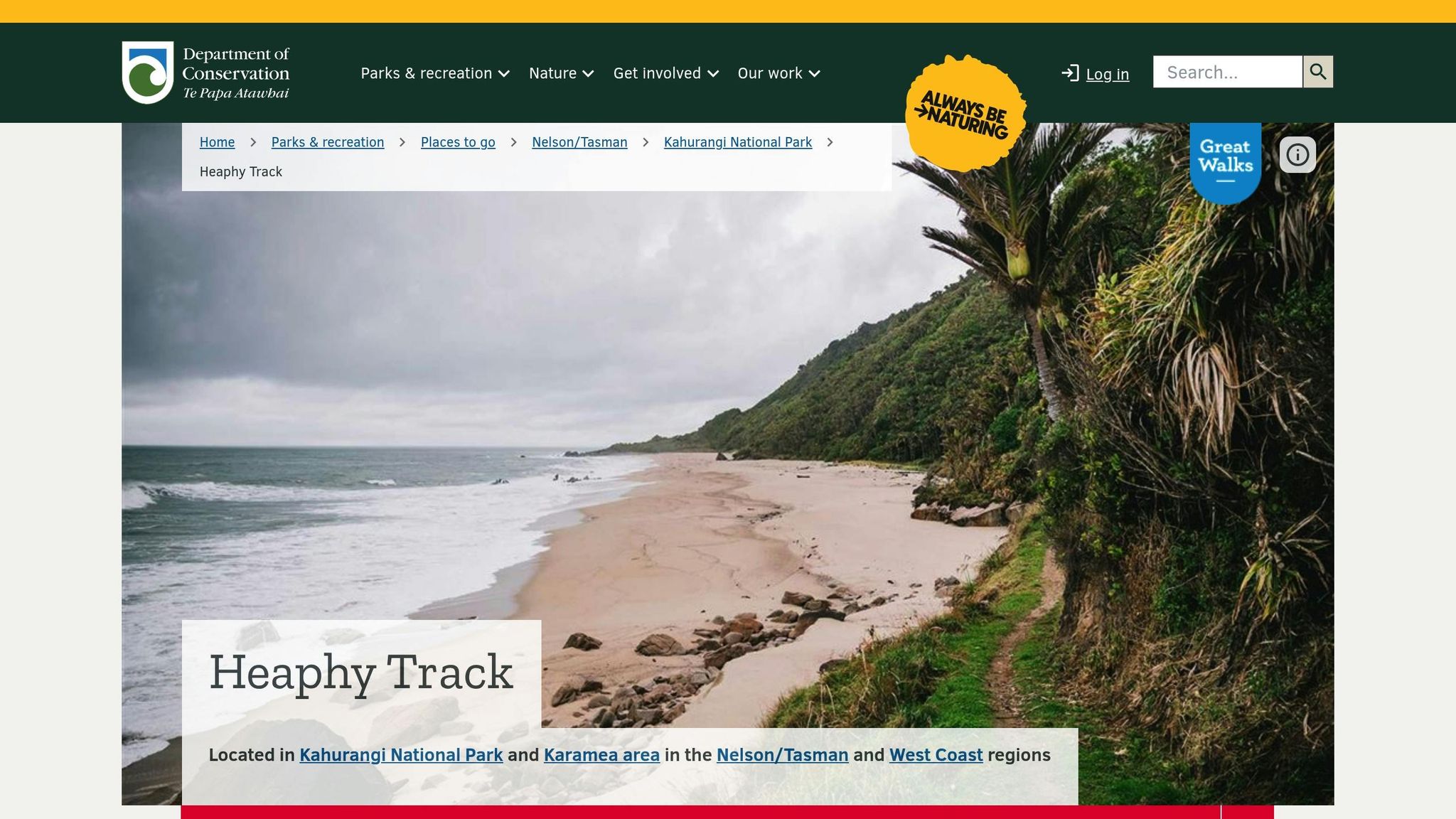
The Heaphy Track spans 48.7 miles (78.4 km) through the stunning Kahurangi National Park. Rated as a Grade 4 (Advanced) trail, it calls for both physical endurance and technical riding skills. Mountain biking is allowed only between May 1 and November 30, and rides are restricted to daylight hours to protect local wildlife, including the great spotted kiwi and the giant Powelliphanta land snail. This combination of challenges and scenery makes it a true adventure for seasoned riders.
Difficulty
This trail is designed for experienced mountain bikers. The route climbs to an elevation of 3,002 ft (915 m) at Flanagans Corner and features technical sections, swing bridges, and areas prone to flooding – sometimes up to 5 ft deep during heavy rain. With annual rainfall exceeding 4,000 mm, conditions can shift quickly, so riders need to be well-prepared. Essentials include bike tools, spare parts, and a personal locator beacon, as cell coverage is limited.
Length
Covering 48.7 miles (78.4 km), the track is divided into six stages. The first segment, from Brown Hut to Perry Saddle Hut, involves a climb of about 3,150 ft (960 m) over 10.9 miles (17.5 km). The longest section stretches 12.7 miles (20.5 km) between James Mackay Hut and Heaphy Hut. Starting at Aorere and finishing at Kohaihai is popular, as it allows riders to enjoy the thrilling singletrack descent from James Mackay Hut to Lewis Shelter. This segmentation makes it easier to plan the journey in scenic, manageable sections.
Typical Riding Time
Most riders complete the track in 2 to 3 days. Bookings for all huts and campsites are required through the Department of Conservation (DOC). Hut fees range from approximately $30 to $44 per night for New Zealand residents and $30 to $66 for international visitors, depending on the season.
Scenic Highlights
"Of all the Great Walks, the Heaphy Track delivers the strongest contrasts and every section of the track is vastly different." – NewZealand.com
The Heaphy Track showcases a variety of landscapes, each more striking than the last. From the expansive tussock downs of Gouland Downs, dotted with limestone arches, caves, and waterfalls, to mossy beech forests and the rugged West Coast beaches lined with nīkau palms, every turn reveals something new. At Mackay Downs, riders can take in breathtaking views of the Heaphy River mouth and the Tasman Sea from 2,460 ft (750 m) above sea level. Before stopping overnight at James Mackay Hut, remember to remove your bike seat and cover hydraulic brake lines to protect them from curious kea.
8. Christchurch Adventure Park
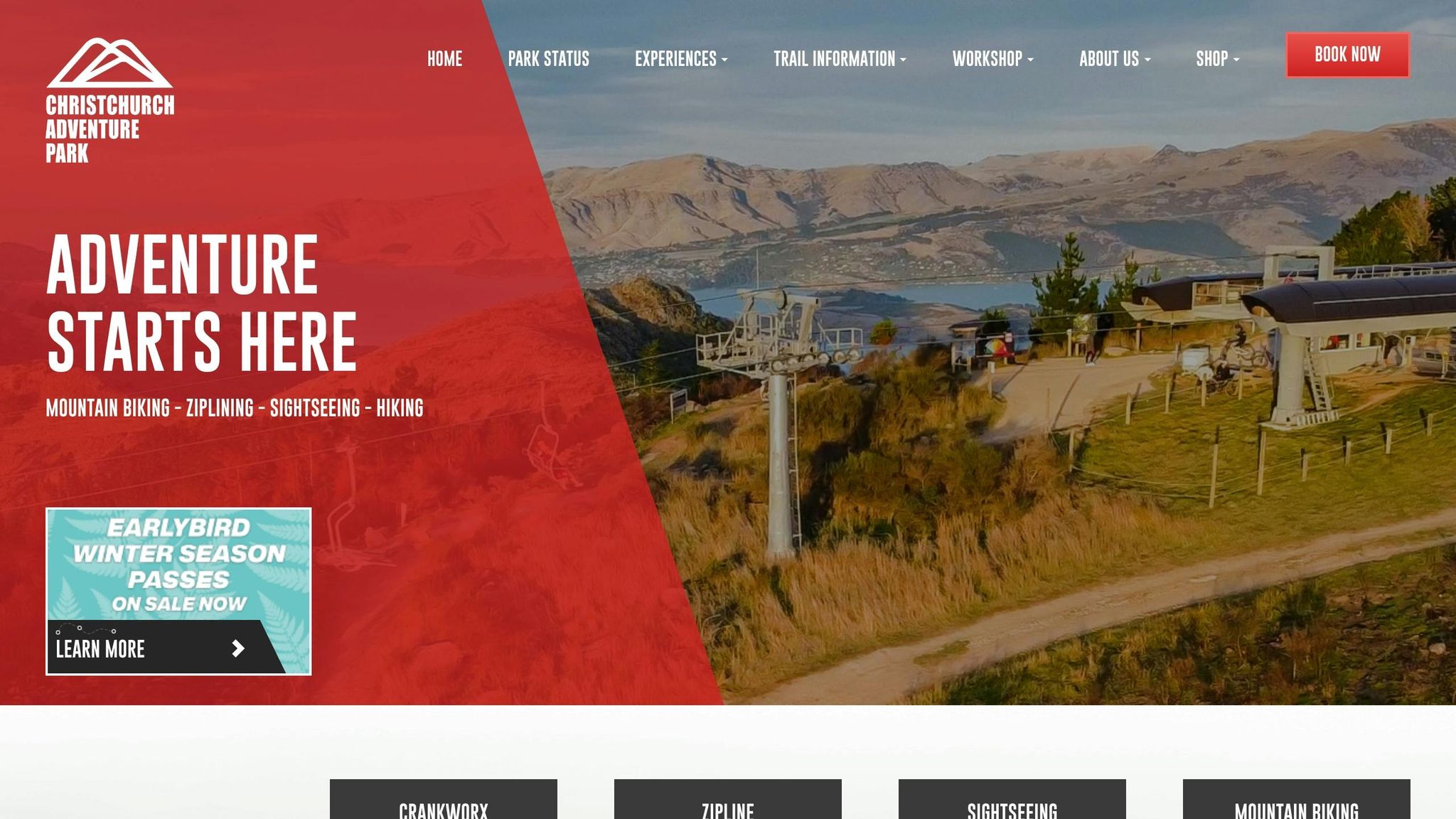
Christchurch Adventure Park stands out as a key destination for mountain biking in New Zealand. Located just 15 minutes from Christchurch’s city center in the Port Hills, this sprawling 500-acre park is the largest bike park in the Southern Hemisphere and boasts the world’s first purpose-built quad mountain bike chairlift. With about 75 miles (120.7 km) of trails and a high-speed lift that climbs 1.8 km while gaining 435 m (1,427 ft) in just 5 minutes, the park can transport up to 1,200 riders per hour. Unlike natural singletracks found elsewhere in New Zealand, this park offers a lift-accessed, engineered environment designed for all skill levels, delivering a "Whistler-style" experience.
Difficulty
The park’s trails are designed to suit every rider, thanks to a five-tier grading system. Beginner (Green) trails feature gentle slopes and wide paths, making them ideal for newcomers. Intermediate (Blue) trails introduce steeper sections and man-made features like berms and tabletops. For more experienced riders, Advanced (Black) and Expert (Black Diamond) trails include steeper descents and technical challenges. The most difficult trails, labeled Pro Line (Double Black), such as Black Pearl, include mandatory jumps and drops with no alternate routes. First-time visitors are encouraged to take an "Intro to Ride" lesson to get acquainted with the trails and lift system.
Length
The park’s trail network offers roughly 50 different combinations, ranging from machine-built flow trails packed with jumps to hand-crafted, technical singletracks winding through pine forests. A standout trail, Airtearoa, features over 50 massive tabletops in an exhilarating descent. Depending on the trail, individual runs take between 5 and 15 minutes, allowing riders to complete multiple laps in a single day. The variety of trails provides a seamless transition from natural terrain to a controlled, adrenaline-fueled environment.
Typical Riding Time
"Multiple laps in a day accelerate technical skill development." – Chain Reaction
A day pass costs $95 for adults and $62 for youth (ages 10–17), granting unlimited access to the trails. For those looking for fewer runs, single uplift passes start at $30 for adults. Thanks to the efficient chairlift system, riders can maximize their time on the trails without the need for exhausting climbs. Riders under 14 must be supervised, carry a mobile phone, and check in with an adult after each lap.
Scenic Highlights
At the summit, 1,427 ft above sea level, riders are treated to breathtaking views of Christchurch, Lyttelton Harbour, the Southern Alps, and the Pacific Ocean. The chairlift ride itself provides a unique aerial perspective of the trails, set against the stunning Canterbury landscape. Back at the base, the park’s village offers a 200-seat café featuring local beers, full-service bike rentals (including Giant Glory bikes), a workshop, and coaching clinics. This blend of modern amenities and scenic beauty makes Christchurch Adventure Park a must-visit destination for riders of all levels.
9. Naseby Forest

Naseby Forest offers a refreshing change of pace from New Zealand’s high-energy bike parks. Nestled near the historic township of Naseby in Central Otago, this working pine forest spans 1,236 acres (500 hectares) and boasts 62 miles (100 km) of trails weaving through Douglas fir, larch, and Corsican pine trees. Unlike the carefully designed tracks at places like Christchurch Adventure Park, Naseby Forest’s trails embrace the natural terrain, giving riders a more organic experience. Best of all, access to this trail network is completely free.
Difficulty
The trails cater to a wide range of skill levels, with grades from 1 to 5. Beginners and families can enjoy the Mount Ida water race, a historic and mostly flat track dating back to 1873, originally used for gold sluicing. It’s a gentle introduction to the forest’s beauty. For seasoned riders, the more technical single-track trails provide a thrilling challenge, winding through areas steeped in New Zealand’s gold-mining history.
Length
With 62 miles (100 km) of interconnected trails, there’s no shortage of paths to explore. The options range from the broad, easygoing Mount Ida water race to narrow, skill-demanding single tracks. A trail map is highly recommended for navigation, as the web of trails can get a bit tricky. Maps are available at the local information center or even at pubs in Naseby. Keep in mind that this is a working forest, so trail availability may be affected by logging activities or fire risks.
Scenic Highlights
The forest’s dense canopy offers refreshing shade and views of Mt Ida and the Hawkdun Range. Riders will also encounter historic gold sluicing areas from the 1870s, adding a layer of historical intrigue to the journey. Many trails start near the local swimming dam, just above Naseby township, which provides a picturesque beginning to your adventure. After your ride, unwind at local favorites like the Black Forest Café or the Maniototo Curling Rink, open year-round. These spots perfectly complement the charm of Central Otago’s historic setting. Together, the natural beauty and rich history make Naseby Forest a standout destination before heading to the final trail at Coronet Peak Bike Park.
10. Coronet Peak Bike Park (Rude Rock)
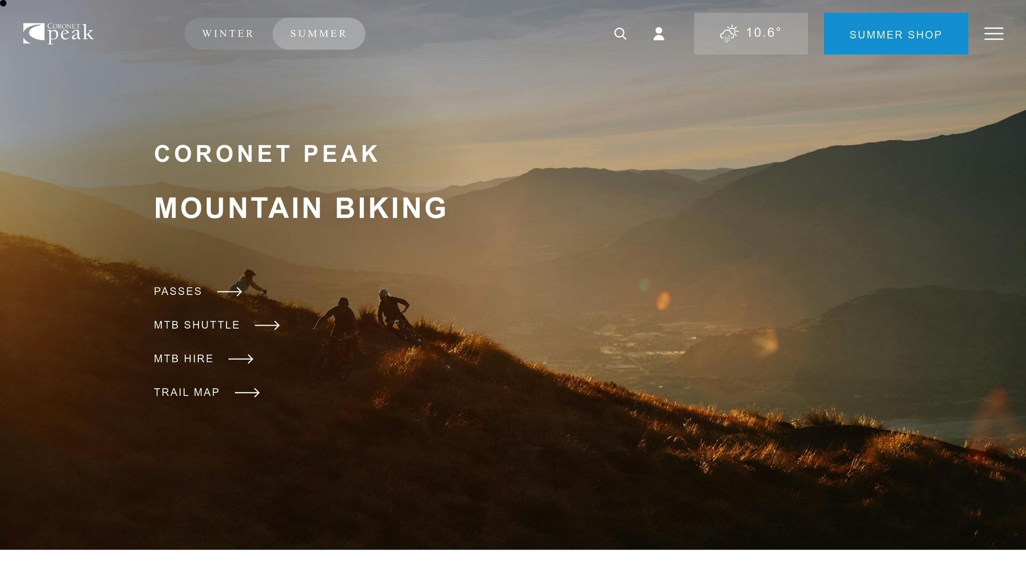
Coronet Peak Bike Park’s Rude Rock trail earns its place as the #1 mountain bike trail on the South Island and ranks #8 in New Zealand. Just 10 miles (16 km) from Queenstown, this downhill-only singletrack cuts through vast sub-alpine tussock landscapes, giving riders a thrilling "top-of-the-world" feeling as they descend. Unlike natural trails, this engineered path offers a distinct downhill experience designed for adrenaline seekers.
Difficulty
Rated Grade 4 (Advanced), Rude Rock is not for beginners. This fast-paced trail is a rollercoaster of technical features, steep drops, and tight corners, all designed to keep experienced riders on their toes.
"an exquisitely crafted, 3km advanced downhill rad roller coaster that’s fast with opportunities for nice air"
The trail’s edges are lined with soft tussock instead of harsh rocks, offering a slightly more forgiving experience if you veer off-track. For less experienced riders, the nearby Wakatipu View trail (Grade 2) provides a much gentler introduction to mountain biking, making it ideal for families and beginners.
Length
The trail measures about 2 miles (3 km) with an elevation change of +399 feet to -415 feet. Since a single descent is over quickly, many riders opt for shuttle services to enjoy multiple runs. Queenstown Bike Taxis, for example, offers a three-hour shuttle window for approximately $60. For those seeking a longer adventure, Rude Rock can be combined with other trails in the "Dirty Four" descent chain, which boasts over 3,937 feet (1,200 meters) of vertical drop.
Scenic Highlights
The trail offers breathtaking 360-degree views of the Southern Alps and the Wakatipu basin. On clear days, you might even spot Aoraki / Mt Cook from the summit. These sweeping vistas are a hallmark of New Zealand’s rugged terrain, making the ride as visually rewarding as it is exhilarating.
"The Coronet Peak trails give you the feeling of being on top of the world. They are stunning… The views from them all are to die for"
The bike park operates from December to April and includes one free shuttle ride with a day pass from designated pick-up points. After an adrenaline-filled day, head to Cafe 1200, conveniently located next to the chairlift, for some well-deserved food and drinks.
Trail Comparison Table
New Zealand’s mountain bike trails offer an incredible variety of experiences, from quick downhill thrills to multi-day backcountry journeys. The North Island is known for its volcanic landscapes and dense, jungle-like forests, while the South Island features alpine ridges, rocky descents, and breathtaking coastal paths. Choosing the right trail depends on your skill level, time, and the type of scenery you’re after.
The country uses a 1–6 grading system for trails, ranging from Grade 1 (Novice) to Grade 6 (Extreme/Downhill-specific). Some trails, like the Heaphy Track and Queen Charlotte Track, are shared with hikers and may have seasonal restrictions. The table below highlights key trails to help you find your next adventure.
| Trail Name | Location | Length | Difficulty | Key Scenery |
|---|---|---|---|---|
| Queen Charlotte Track | Marlborough | 45.7 miles (73.5 km) | Intermediate/Advanced | Coastal bays and stunning Marlborough Sounds views |
| Old Ghost Road | West Coast | 53 miles (85 km) | Advanced/Expert | Mōkihinui River and historic gold mining relics |
| Whakarewarewa Forest | Rotorua | 100+ miles (160+ km) | Grade 1–6 | Towering Redwoods and geothermal landscapes |
| Great Lake Trail | Taupō | 56 miles (90 km) | Intermediate | Lake Taupō, waterfalls, and volcanic peaks |
| Timber Trail | Pureora Forest | 53 miles (85 km) | Easy/Intermediate | Ancient forests and dramatic suspension bridges |
| St James Cycle Trail | Hanmer Springs | 40 miles (64 km) | Easy/Advanced | Alpine meadows and high-country stations |
| Heaphy Track | Nelson/West Coast | 48 miles (78 km) | Advanced | Limestone cliffs and palm-fringed coastline |
| Christchurch Adventure Park | Christchurch | 44 trails | Grade 1–6 | Pine forests with Pacific Ocean views |
| Naseby Forest | Central Otago | 62 miles (100 km) | Grades 1–5 | Gold sluicing history, native forests, and sweeping views |
| Coronet Peak (Rude Rock) | Queenstown | 6 miles (10 km) | Advanced (Grade 4) | Spectacular views of Lake Wakatipu and the Remarkables |
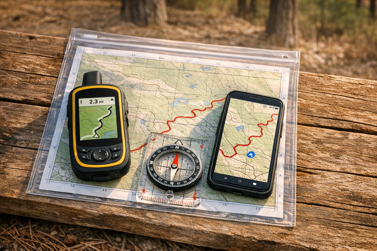
For trails like the Old Ghost Road or Great Lake Trail, plan ahead for shuttles or water taxis to make logistics easier. Keep in mind that the Heaphy Track allows mountain biking only from May 1 to November 30 to prioritize hikers during peak season. For remote routes like Old Ghost Road, a GPS or map is essential since cell coverage is sparse.
Conclusion
New Zealand offers an incredible variety of biking landscapes, ranging from geothermal forests and coastal ridges to alpine meadows. With over 776 trails spanning both islands, there’s something for every rider. Whether you’re into quick downhill thrills at gondola-accessed parks or seeking epic journeys on trails like the Old Ghost Road, New Zealand delivers. The North Island’s lush, green forests provide a stark yet stunning contrast to the South Island’s high-altitude alpine scenery.
Planning your trip is straightforward, thanks to excellent biking infrastructure. Rotorua alone boasts over 200 kilometers (about 124 miles) of meticulously designed trails. Meanwhile, Queenstown and Christchurch are home to lift-assisted downhill parks that cater to adrenaline seekers. If you don’t want the hassle of bringing your own bike, rental options are widely available. For multi-day rides on trails like the Timber Trail or Heaphy Track, it’s wise to book backcountry huts in advance, as availability is often limited.
Timing your visit can make a big difference. Spring (September to November) and autumn (March to May) generally provide the best riding conditions, while summer heat can be intense, especially on the South Island. Keep in mind that some trails, like the Heaphy Track, are only open to bikers during winter months. Familiarizing yourself with New Zealand’s Grade 1–6 trail system ensures you pick routes suited to your skill level.
Before heading out, check out gear recommendations from Intermountain Bikes to prepare for New Zealand’s diverse terrains. With the right planning and preparation, your ride in New Zealand could easily become an adventure you’ll never forget.
FAQs
Which New Zealand MTB trail is best for my skill level?
New Zealand is a haven for mountain biking enthusiasts, offering trails for every skill level. The best trail for you depends on your experience and how comfortable you are with different terrains.
- Grade 1 Trails: Perfect for beginners, these trails are smooth and flat, providing an easy and relaxing ride.
- Grade 3 Trails: If you’re an intermediate rider, try the St James Cycle Trail. It offers steeper slopes and more of a challenge without being overwhelming.
- Grade 4 Trails: Advanced riders can tackle trails like the Grandview Mountain Track. These routes feature steep climbs and technical obstacles, demanding both skill and stamina.
When choosing a trail, consider your fitness level and riding experience to ensure a fun and safe adventure.
Do I need permits or seasonal bookings for these trails?
Some trails, like Queenstown Bike Park and Bike Glendhu, require you to purchase passes or season tickets. On the other hand, trails managed by the Department of Conservation usually don’t need permits, though they might have specific booking rules or access conditions. Always review the guidelines for each trail to stay informed.
What gear should I pack for remote multi-day rides?
For multi-day remote rides, it’s crucial to pack smartly for safety, comfort, and bike maintenance. Start with the basics: a helmet, spare tubes, a pump, a multi-tool, a derailleur hanger, and extra brake pads. These will help you handle common bike issues on the trail.
For personal comfort and protection, bring layered clothing to adapt to changing weather, rain gear, sunscreen, and a reliable hydration system. A first aid kit should always be part of your gear, just in case.
Don’t forget navigation tools to stay on course, a headlamp for nighttime visibility, and a tubeless repair kit if your bike setup requires it. These essentials can make all the difference in keeping your adventure smooth and enjoyable.